02 / FEATURE INSPECTOR
Read the drawing, feature by feature.
Select an outline above or choose a feature to see its mapped dimensions, interpretation and evidence limits.
GEORGETOWN · JELUTONG · PENANG
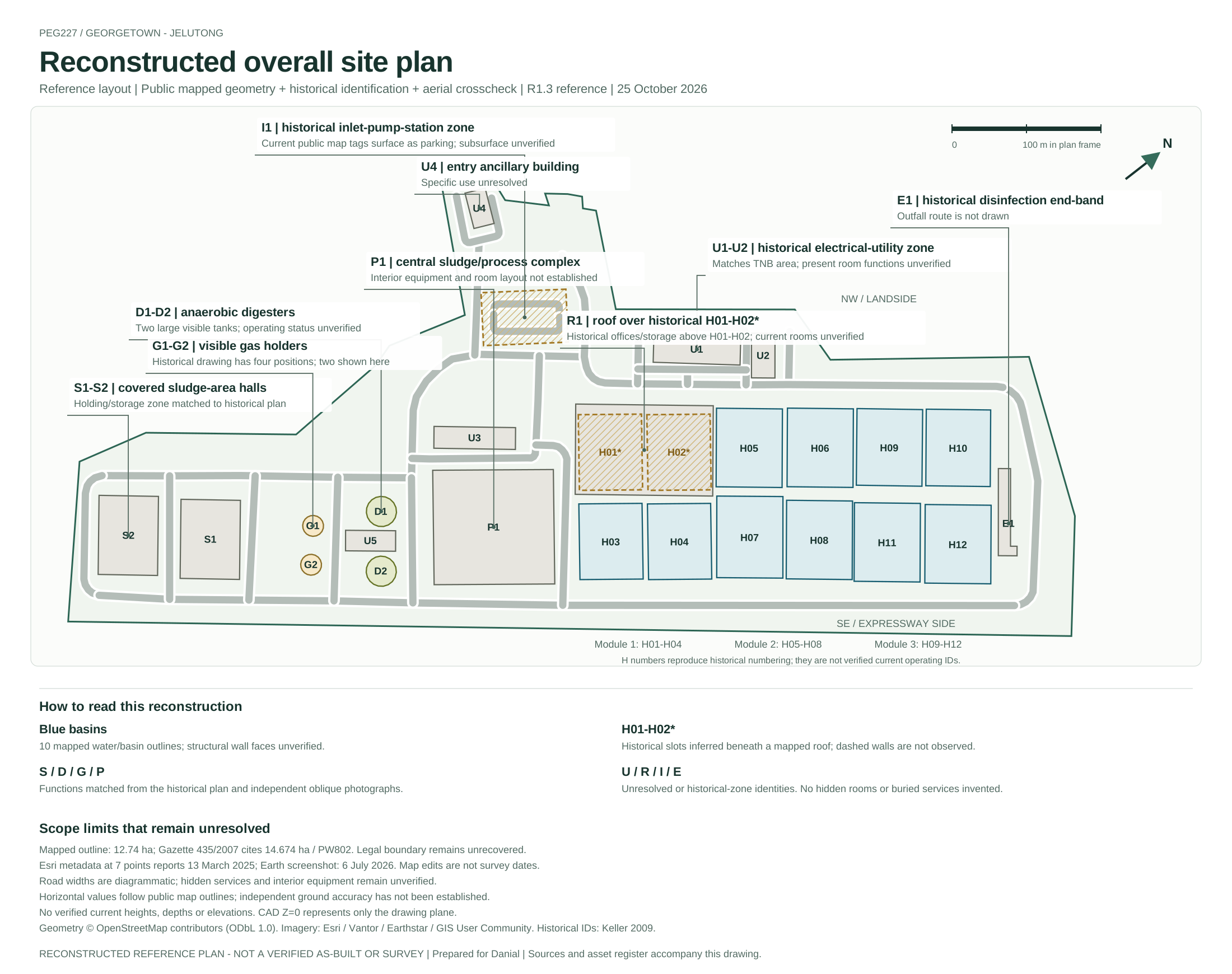
Explore the reconstructed layout of Georgetown Sewage Treatment Plant PEG227. Compare our drawing with the actual Google Maps satellite screenshot, then inspect the sources behind each interpretation.
Public map outlines and historical engineering sources. A verified current as-built drawing has not been recovered.
Browse the evidence01 / DRAWING WORKSPACE
Select an outline to inspect its evidence
02 / FEATURE INSPECTOR
Select an outline above or choose a feature to see its mapped dimensions, interpretation and evidence limits.
03 / DIMENSIONS & HEIGHT
04 / ALIGNMENT & ACCURACY
Toggle the overlay to compare each edge with the photograph. The overlay uses the observed north-up map centre and zoom, with visual checks at basin corners and digester centres.
A close screen match does not certify ground dimensions. Roof displacement, source age and edge identity remain uncertain. Esri’s reported 8.47 m positional metadata is not a length tolerance.
View screenshot registration ↗Read measurement audit ↗05 / TAKE THE DRAWING WITH YOU
Current vector revision: R1.3-reference. The six-page PDF remains the previously checked R1.2 edition.
Historical whole-site drawings, engineering papers, operator records, aerial imagery and site photographs — together in one evidence library.
46 sources · 64 previews ↗